FREE SHIPPING ON DOMESTIC ORDERS MORE THAN $149!


![C-MAP M-NA-Y212-MS US Lakes North Central REVEAL Inland Chart [M-NA-Y212-MS]](http://www.dbmarinesupplies.com/cdn/shop/files/87547XL_1200x.jpg?v=1741092506)
![C-MAP M-NA-Y212-MS US Lakes North Central REVEAL Inland Chart [M-NA-Y212-MS]](http://www.dbmarinesupplies.com/cdn/shop/files/87547XL.jpg?v=1741092506 "C-MAP M-NA-Y212-MS US Lakes North Central REVEAL Inland Chart [M-NA-Y212-MS]")
- Choosing a selection results in a full page refresh.
FREE SHIPPING ON DOMESTIC ORDERS MORE THAN $149!
![C-MAP M-NA-Y212-MS US Lakes North Central REVEAL Inland Chart [M-NA-Y212-MS]](http://www.dbmarinesupplies.com/cdn/shop/files/87547XL_medium.jpg?v=1741092506)
Couldn't load pickup availability
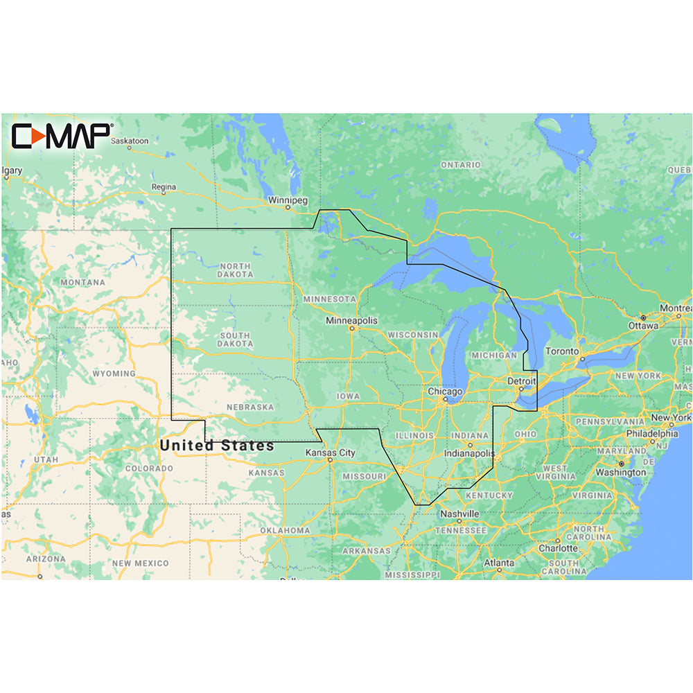
M-NA-Y212-MS US Lakes North Central REVEAL™ Inland Chart
Whether cruising or fishing or C-MAP® REVEAL™ Lakes charts offer the very best of C-MAP. With Shaded Relief, including Reveal Seafloor, Aerial Photography and Satellite Overlay presentation added to the core C-MAP features found in DISCOVER™ – full-featured Vector Charts, with Custom Depth Shading, Tides & Currents and Easy Routing. It also includes the very best of C-MAP High-Resolution Bathymetry, including integrated Genesis® data.
*Purchase includes a full 12 months of online updates.
**Compatible with Lowrance, Simrad & B & G Chartplotters.
Features:
Thanks for subscribing!
This email has been registered!